
N 42° 57.883′ by W 086° 13.305′
The loss of the wooden schooner Vermont nearly took the life of one of Grand Haven’s future heroes.
The 100-ton, 87-foot vessel, built in 1845 in St. Joseph, Michigan, had a safe career on the lakes until December 10, 1855. She was bound from Chicago to Grand Haven with a load of lumber camp supplies and 100 bags of oats in the company of the schooner Telegraph, when a sudden storm came up. The Telegraph was able to negotiate the shifting sand bars and enter the harbor, but the wind shifted as the Vermont came in and blew the vessel ashore well south of Grand Haven.
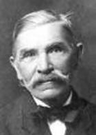
Richard J. Connell later in life
Twenty year old Richard J. Connell, a native of County Meath, Ireland, was First Mate on the Vermont when it wrecked. Connell swam ashore from the foundering ship and reportedly was pulled from the surf by four Indians. He then was assisted to safety by local resident Philip Dushane, and later returned to rig a breeches buoy that allowed the remaining 18 of his fellow crew members to be saved, including Captain Robert Genie.
When Grand Haven’s first U.S. Life-Saving Station began operation in 1871, Captain Connell stepped up to head the service and he remained as keeper until 1881. Connell’s greatest feat occurred when the ship Ironsides sank in a storm off Grand Haven harbor on September 15, 1873. Captain Harry Sweetman and at least 22 others lost their lives when their lifeboats capsized in the rough waters, but 20 passengers and crew were saved.
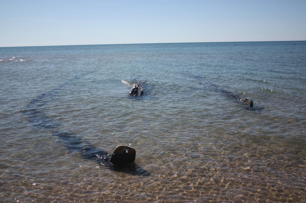
The storm pounded the Vermont to pieces in the days to follow. At the time of the loss, the Vermont was owned by Clark B. Albee and valued at just $5,000. She was called a “total loss.” Unsubstantiated reports say she was raised in 1859. However, the bow of a very old wooden schooner was uncovered by shifting sands in 2002. The remains are thought to be those of the Vermont.
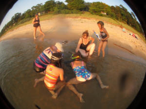
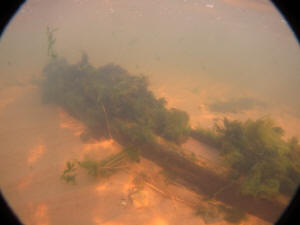
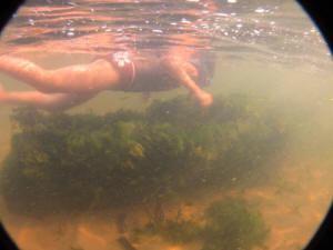
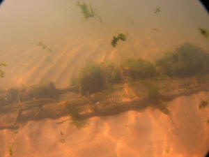
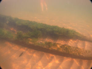
Beachcomber Cynthia Melinn called this wreck to the attention of MSRA in 2011. MSRA members used the wreck to introduce a group of children to shipwrecks and maritime history, surveying the wreck with their assistance. Unlike most wrecks that remain in the surf line, and have been sheared down by the action of the waves and ice to just the lowest portions of the vessel, this one is different. (Story continues below)
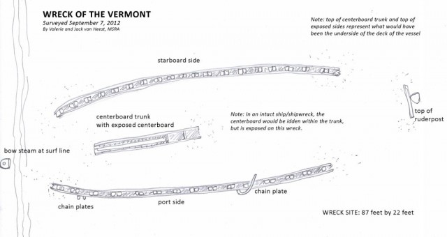
A drawing of the remains of the Vermont by Valerie van Heest
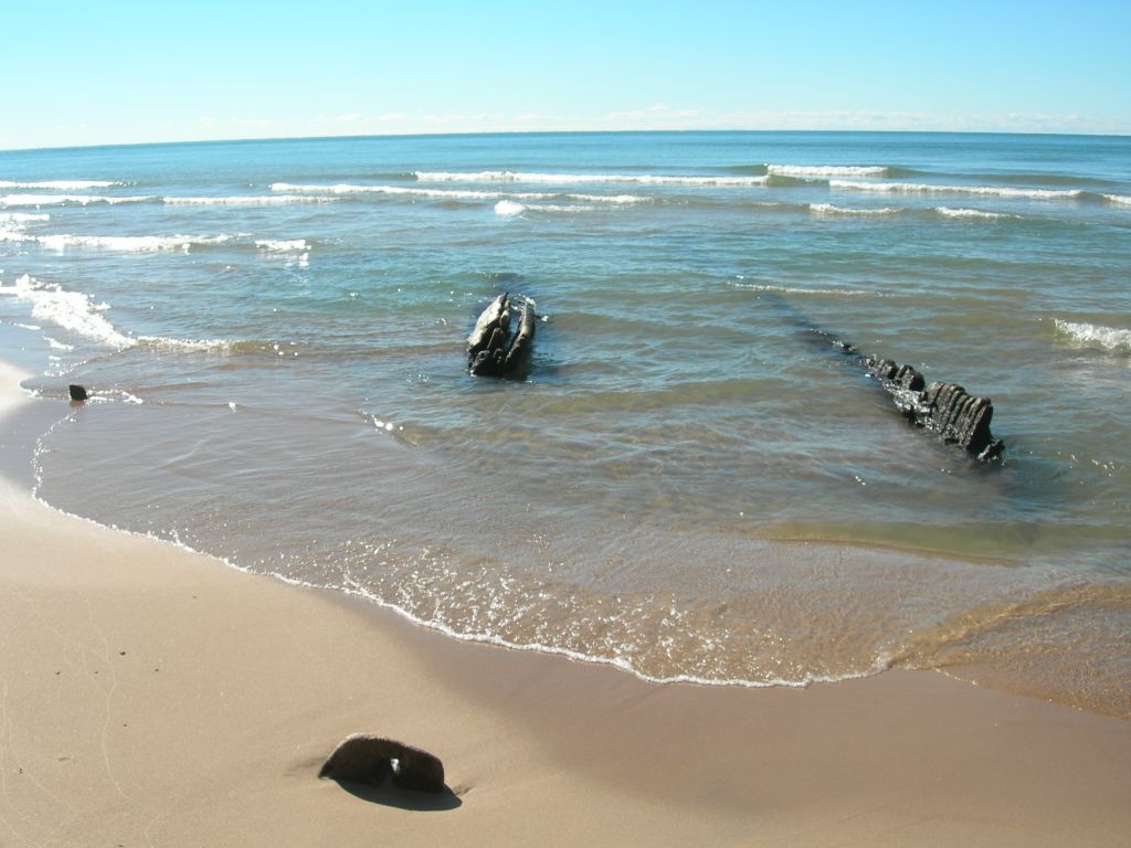
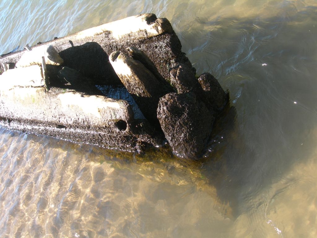
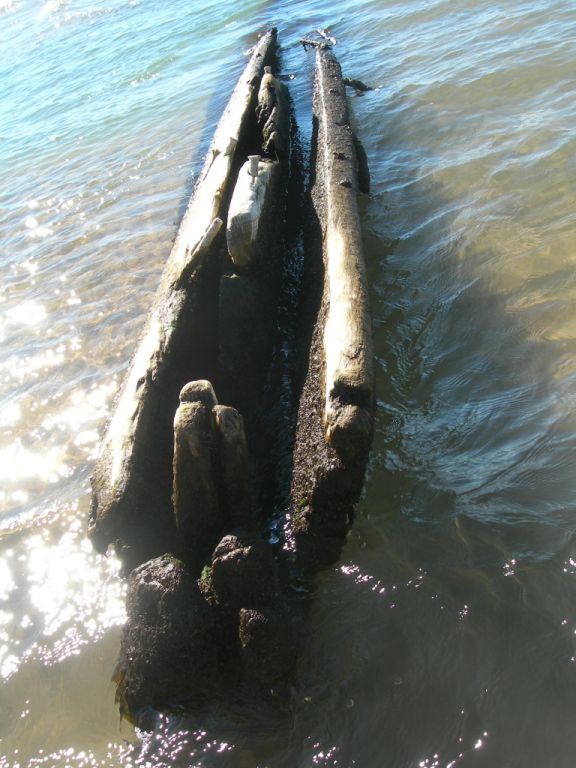
All that was visible was the top of the centerboard trunk (a feature that is about 8 feet above the keelson), the tips of the frames which make up the sides of the vessel, and a small piece that appears to be the stem at the bow. The presence of these architectural features suggest that the bulk of the ships sides and lower hull may be buried under 8 or 10 feet of sand. Based on the dimensions from stem to end of centerboard trunk, the vessel is consistent with the dimensions of the Vermont.
In addition, homeowners in this area, who have seen the wreck come and go as the sands shift, all believe it to be the Vermont, a story passed down from several generations. This was not the first time the Vermont surfaced to excite local residents and it wouldn’t be the last.
Please be aware that the Vermont wreckage lies in public waters, but not directly accessible from shore without trespassing on private property. Proper etiquette would dictate the site be approached by walking along the beach (in the surfzone) from a public access point, or approached by boat from the water. The approximate coordinates are: N 42° 57.883′ by W 086° 13.305′.
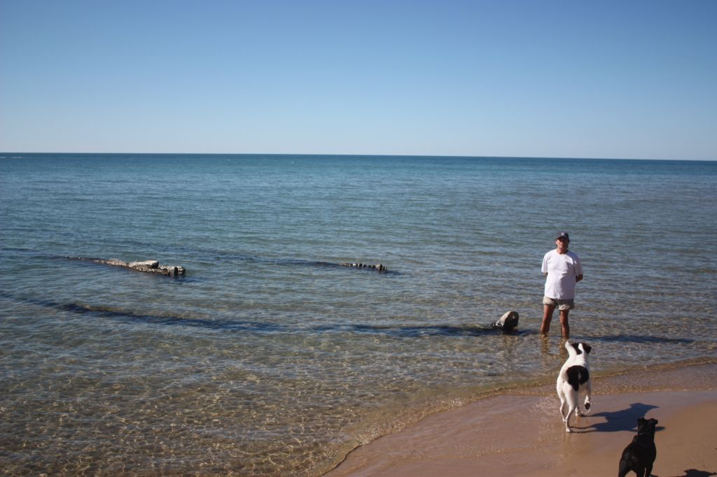
Here are some photos of the 2011 exploration of the Vermont by a group of local children under the direction of MSRA.